A Simple Guide to Finding Gold and Mining Data in Saudi Arabia’s Geological Database
Explore how to navigate Saudi Arabia's NGD and SGS portals, uncover hidden geological insights in relinquishment reports, and use smarter AI tools to accelerate mineral exploration. A practical guide for geologists, researchers, and data strategists.


Exploring for minerals like gold in Saudi Arabia? You’ve likely come across the National Geological Database (NGD) and the Saudi Geological Survey (SGS) portal. These two connected platforms house massive amounts of geological information—ranging from maps and boreholes to mineral occurrences and exploration reports.
But let’s be honest: finding what you actually need can be frustrating. The portals are powerful, but navigating them—especially for first-time users or busy geologists—can take longer than expected.
This guide breaks down:
- How to use NGD’s main features
- What data you’ll find (and what you won’t)
- Common challenges while searching for gold deposits
- Smarter ways to search across unstructured reports (Bibliographic Database for NGD)
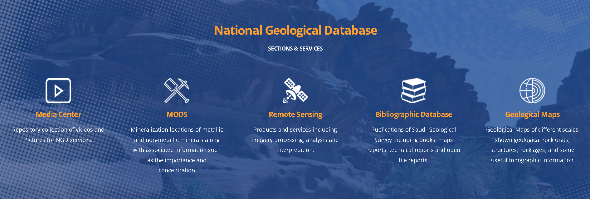
What Is Saudi Arabia’s NGD and What Can You Find?
The National Geological Database Portal (NGD) provides a map-based interface where you can explore:
- Geological and topographic maps
- Mineral occurrences (like gold, copper, phosphate, etc.)
- Borehole data
- Surface samples and mining projects
- Exploration reports
The interface feels a bit like Google Maps, but with geological data layers you can toggle on/off using checkboxes.
Step-by-Step: How to Use NGD’s Key Tools
Here’s a quick overview of the most helpful icons and functions:
1. Map Content Panel
- Lets you view layers such as:
- Topographic and geological maps (at various scales)
- Boreholes and sample locations
- Mining areas
- Use checkboxes to view multiple layers at once
2. Search Geological Data
- Draw a shape (polygon, line, or rectangle) over your area of interest
- Filter by commodity (like Gold)
- Points will appear showing reported occurrences
3. Download Data
- Draw a box over your area, then select data types to download
- You’ll need to sign in and select a relevant toposheet
4. Catalog Search
- Useful if you already know the name of a dataset
- Offers better control for researchers familiar with technical terms
5. Zoom to Coordinates
- Search directly by latitude/longitude
There’s also a helpful tutorial section if you’re just starting out.
But Here’s the Catch: Common Challenges with NGD
While NGD and SGS provide a wealth of data, there are a few real-world challenges many users face:
| Challenge | Why It Matters |
|---|---|
| 🔸 Data not always updated | Exploration is moving fast; outdated reports can mislead targeting |
| 🔸 No keyword-style search in PDFs | You can’t search for gold grades, styles of mineralization, or associated rocks in context |
| 🔸 Reports often have unfamiliar names | You may miss valuable files simply because of naming inconsistency |
| 🔸 Unstructured reports are hard to process | Relinquishment reports (from past explorers) are full of hidden insights but are hard to search |
| 🔸 Data visualisation is manual | You need to manually extract coordinates from reports and plot them—slow and error-prone |
🏆 Smarter Ways to Work with Unstructured Geological Reports
If you're serious about uncovering overlooked gold targets, relying solely on structured map layers won’t cut it. You’ll need to dive into relinquishment and exploration reports—an often underused but highly valuable resource. These reports document exploration programs that didn’t progress to mining and, while publicly available, are difficult to locate and extract insights from. Yet they’re rich in geological detail—drill logs, assays, geophysical surveys—and often hold clues others miss.
These reports typically are:
- Scanned PDFs with maps, handwritten notes, and assay tables
- Not included directly in NGD’s spatial search
- Not easily searchable by context or combination of keywords
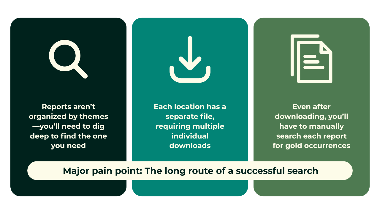
For example, a relinquishment report might mention a high-grade gold intersection just 2 km from a known deposit—but unless you manually open and read through the document, that information remains hidden. These reports are rarely spatially referenced, not searchable by theme or keyword, and are not summarized within the NGD interface. As a result, exploration efforts can often be delayed, duplicated, or even misdirected.
In many cases, drilling reports labeled as "failed" projects were originally intended to explore for a specific mineral. These efforts may have halted due to poor economic viability at the time—but the reports still contain valuable data. For modern researchers, such information can offer key geological clues, whether for land mapping or targeting different commodities than originally sought.
So how do you tap into this hidden knowledge at scale?
That’s where AI steps in:
 Russell Menezes
So how can you work smarter?
Many geologists and analysts rely on a mix of tools to handle large volumes of unstructured data:
✅ Common Alternatives
| Tool | Strength | Limitation |
|---|---|---|
| SharePoint / Google Drive | Good for storage and sharing | Poor search across large PDF datasets |
| NotebookLM (RAG solutions) | Useful for extracting key text from files | Needs customization for mining terms |
| Amazon Kendra (Vector search) | Good semantic matching for large datasets | Requires training on sample data |
These options are helpful but not designed specifically for geological datasets. They also lack spatial integration.
💡 A Better Way: Intelligent Mining Search Tools
Some AI platforms are now tailored for mining workflows. For example, tools like RadiXplore are designed to:
- Read scanned PDFs, maps, and tables—even if handwritten
- Understand context across different mining terms
- Let you search with multiple keywords and extract insights quickly
- Visualize findings on a map automatically
While traditional databases fall short in handling unstructured, legacy geological data, purpose-built AI tools are stepping in to bridge that gap. These platforms don’t just extract data—they make it usable, searchable, and spatially aware. To illustrate the difference, here’s a side-by-side look at some of the common challenges explorers face today—and how RadiXplore is uniquely equipped to solve them:
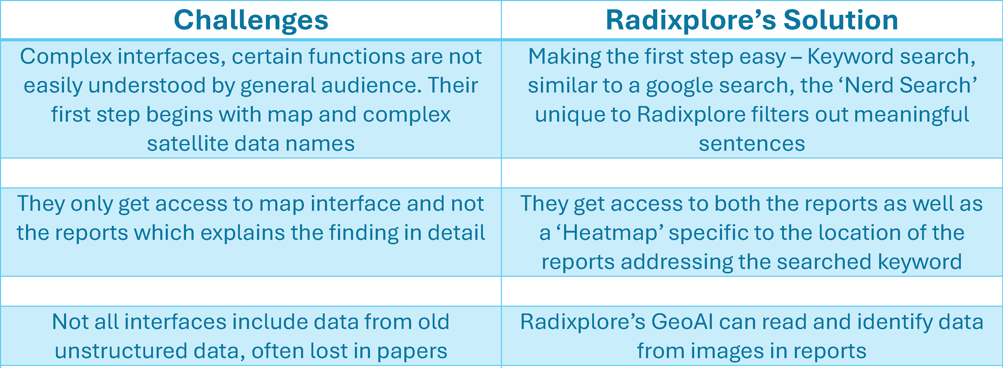
This isn’t about replacing your geological knowledge—it’s about helping you spend less time searching and more time interpreting. Here is a case study which shows how a purpose built mining AI platform like RadiXplore increases your chances of uncovering unrecognized mineral deposits significantly compared to manual means.
Russell Menezes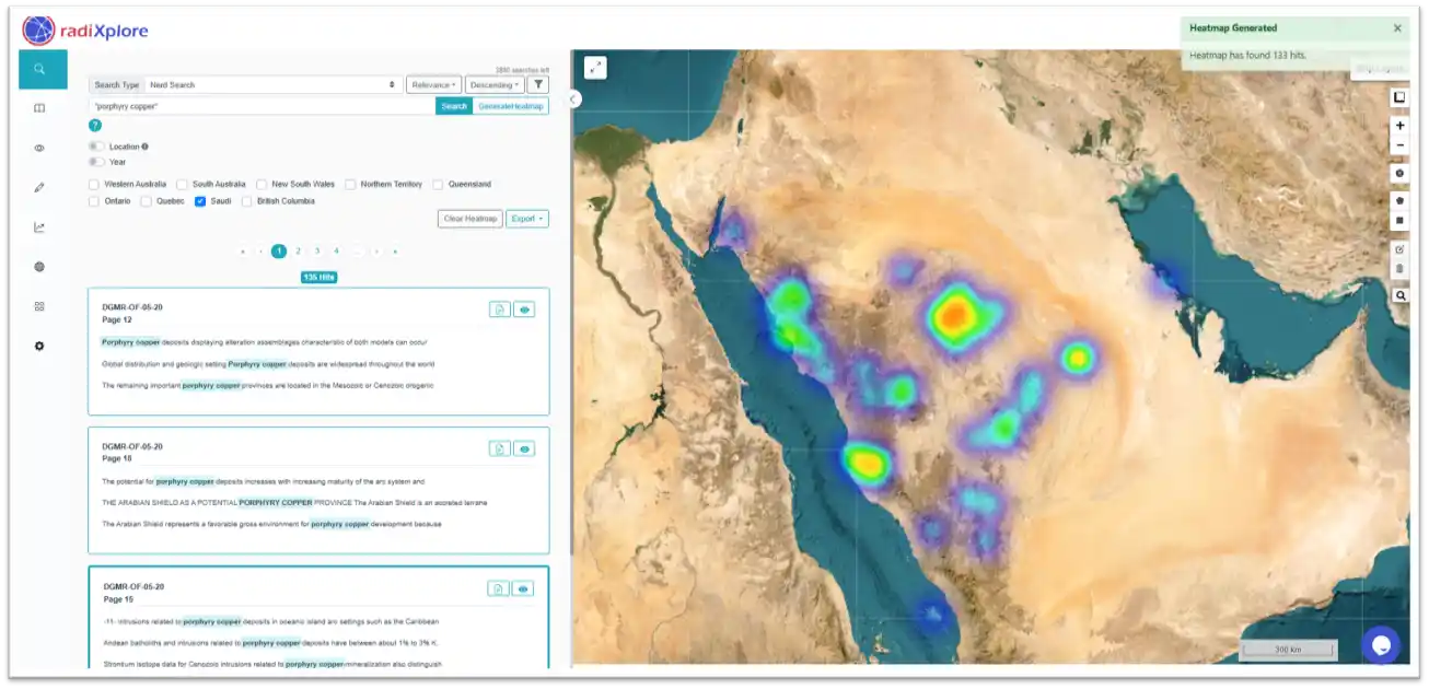
Final Thoughts: The Real Goal of Data Search
The future of geological databases isn’t just about having more data—it’s about making that data accessible and useful. For researchers, geologists, and project managers, the goal is clear:
Find high-quality targets faster, with less manual effort.
As Saudi Arabia pushes for mineral discovery and development, it becomes essential that geological databases evolve in these ways:
- Semantic Search: Understand meaning, not just keywords
- Linked Data: Connect maps, reports, tables, and boreholes into one view
- Responsive Design: Fast, user-friendly interfaces even on mobile
- Dynamic Visuals: Heatmaps, clustering, overlays, and 3D terrain
- Data Integrity: Versioning, source attribution, and QC markers
- AI-Augmented Review: Summary suggestions and anomaly detection
This is the direction in which RadiXplore and other new-age platforms are heading. Whether you’re just starting with NGD or looking for ways to improve your current process, tools that combine structured and unstructured data—like intelligent search, smart visualization, and AI-driven exploration—are key.
📌 Better Data, Better Discoveries...
Whether you're scanning for gold in ancient greenstone belts or reviewing phosphate prospects, the tools you use to search make all the difference. Saudi Arabia's NGD and SGS offer a strong foundation—but they’re just the starting point.
By combining spatial search with smarter tools that work across structured and unstructured data, you reduce time spent on manual review and maximize your chance of discovering something valuable.
In mineral exploration, that’s often the difference between a "near miss" and a new mine. Want to learn how platforms like RadiXplore streamline geological research?
Russell Menezes
We believe in minimising the time required for project generation, data review and maximising the possibility of discovering the unexplored with efficiency.