
How to Use India's National Geoscience Data Repository (NGDR) for Mineral Exploration
Learn how to use India's National Geoscience Data Repository (NGDR) to access geological, geochemical and geophysical data for mineral exploration and targeting.

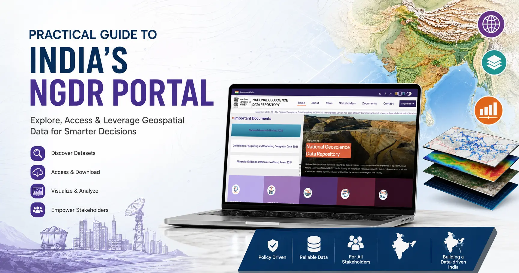
India has accumulated decades of geological mapping, geochemical surveys, geophysical data and mineral exploration reports.
The challenge has traditionally been accessing that information efficiently enough to use it in exploration.
The National Geoscience Data Repository (NGDR) was created to address this problem. Developed under India's National Mineral Exploration Policy, the NGDR brings baseline and exploration-related geoscientific data into a central GIS-enabled platform, with the Geological Survey of India (GSI) as the nodal agency.
For exploration teams assessing ground in India, NGDR provides a valuable starting point for understanding what data exists, what exploration has already taken place and where further investigation may be warranted.
But finding the data is only the first step.
This guide covers:
- What the National Geoscience Data Repository is
- What data is available through NGDR
- How to search for mineral exploration reports and spatial data
- How NGDR can support mineral targeting
- Where the data-access workflow ends
- How RadiXplore can help turn multiple sources of exploration data into connected geological evidence
What is the National Geoscience Data Repository?
The National Geoscience Data Repository, or NGDR, is India's central digital repository for exploration-related geoscientific information.
The Ministry of Mines conceptualised NGDR as part of the National Mineral Exploration Policy 2016, with the goal of bringing baseline and mineral exploration information generated across India into a common geospatial environment.
The platform includes information contributed by organisations across India's geoscience and mining ecosystem, including:
- Geological Survey of India (GSI)
- Mineral Exploration and Consultancy Limited (MECL)
- State Directorates of Geology and Mining
- Government agencies and public sector organisations
- Research institutions
- Private exploration and mining organisations
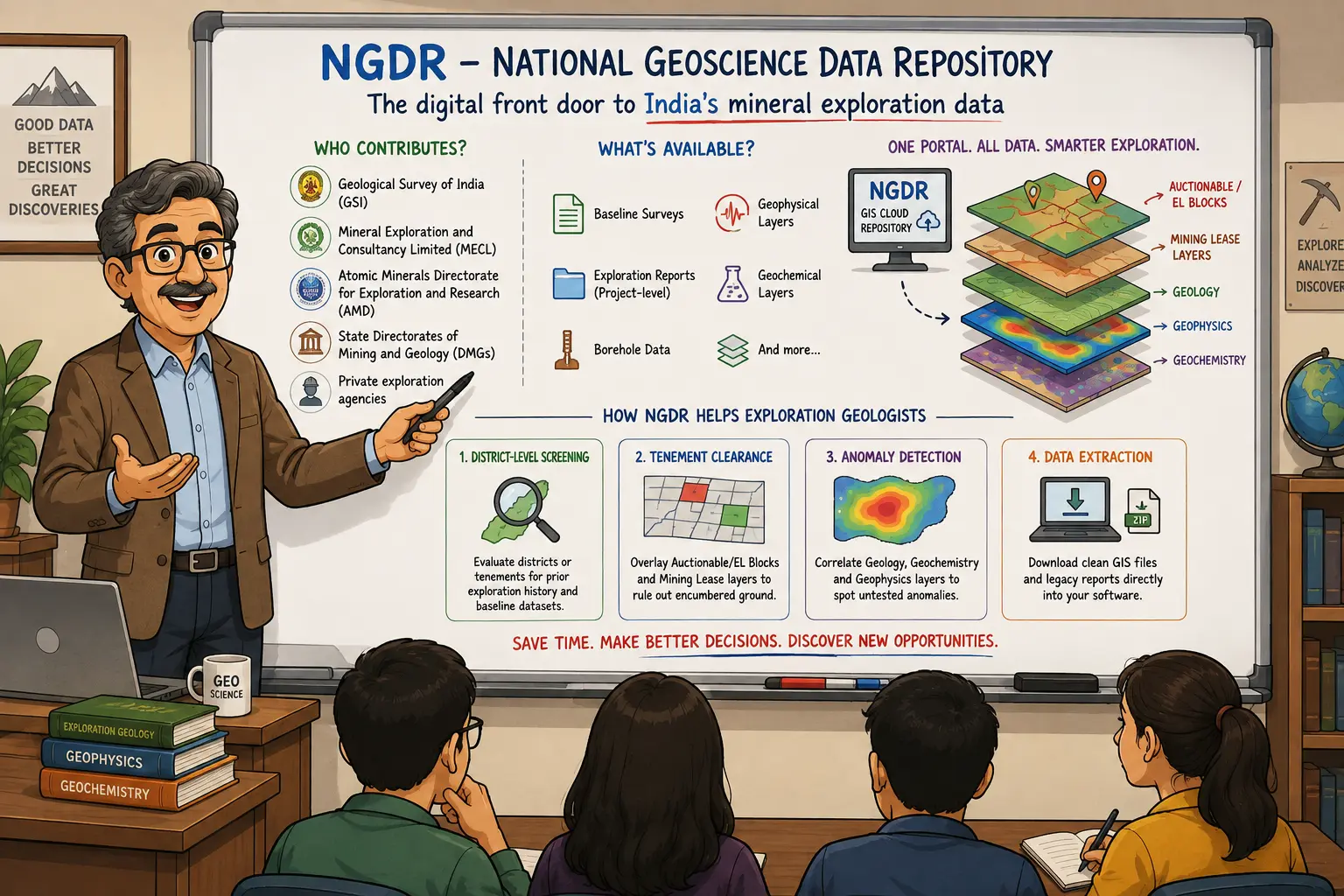
Exploration information is progressively being standardised through the Mineral Exploration Reporting Template (MERT) and converted into GIS-compatible formats.
The scale of the repository is already significant.
By the end of 2025, NGDR contained 16,369 geoscientific reports, including 13,080 GSI reports and 3,289 reports from other stakeholders. More than 65,000 data and report downloads had been recorded by national and international organisations and institutions.
For mineral explorers, this makes NGDR an important entry point into India's public exploration knowledge.
What Data Can You Find in NGDR?
NGDR brings several types of geoscientific information into the same platform.
Depending on the area and available coverage, users can access or investigate data such as:
- Geological maps
- Geochemical datasets
- Geophysical datasets
- Mineral exploration reports
- Baseline geoscience reports
- National Geochemical Mapping data
- National Geophysical Mapping data
- National Aero-Geophysical Mapping Programme data
- Exploration block boundaries
- Project boundaries
- District resource maps
- Exploration licence block boundaries
- GIS-compatible spatial datasets
The Ministry of Mines originally launched NGDR with geological, geochemical and geophysical map services that could be viewed, accessed and downloaded together, specifically to support interpretation and mineral targeting.
For an exploration team, that creates several useful starting workflows.
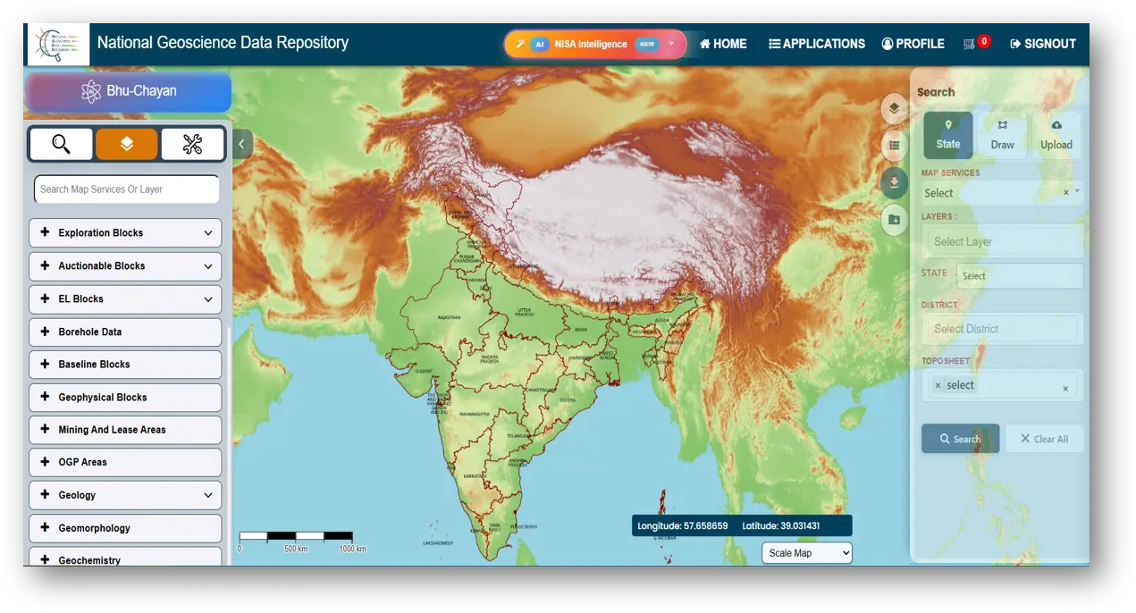
Regional exploration screening
Review available geology, geochemistry, geophysics and historical exploration across a district or prospective region before committing significant resources to detailed investigation.
Historical exploration review
Identify reports from earlier exploration campaigns and understand where previous work was conducted, what commodities were targeted and which areas received more or less attention.
Preliminary ground screening
Compare exploration information against available project, block and licence boundaries to better understand the exploration context of an area.
Mineral targeting
Overlay complementary geoscientific datasets to identify geological relationships, anomalies or areas that may warrant closer investigation.
Source data acquisition
Download relevant reports and spatial data for further interpretation in GIS, geological modelling or other exploration workflows.
How to Use the NGDR Portal for Mineral Exploration
The NGDR interface may continue to evolve, but the underlying workflow is straightforward: define the area or commodity you are interested in, identify relevant reports or datasets, review their metadata and spatial context, then retrieve the underlying information.
Step 1: Register and sign in
Create an NGDR user account and log in to the portal.
The current login process supports OTP verification using a registered email address or mobile number.
Once logged in, users can access the NGDR map and data services.
Step 2: Open the NGDR Map Service Gateway
From the NGDR portal, open the NGDR Map Service Gateway.
This launches the GIS environment used to search, visualise and explore spatial and report-based information.
Step 3: Define what you are looking for
NGDR allows users to search across exploration information using criteria such as:
- Location
- Commodity
- Report type
- Organisation
- Publication year
- Keywords
- Spatial extent
For an initial exploration review, location and commodity are often the most useful starting points.
For example, an explorer investigating copper potential in a particular district could use the geographic filters to isolate the area before narrowing the results by commodity.
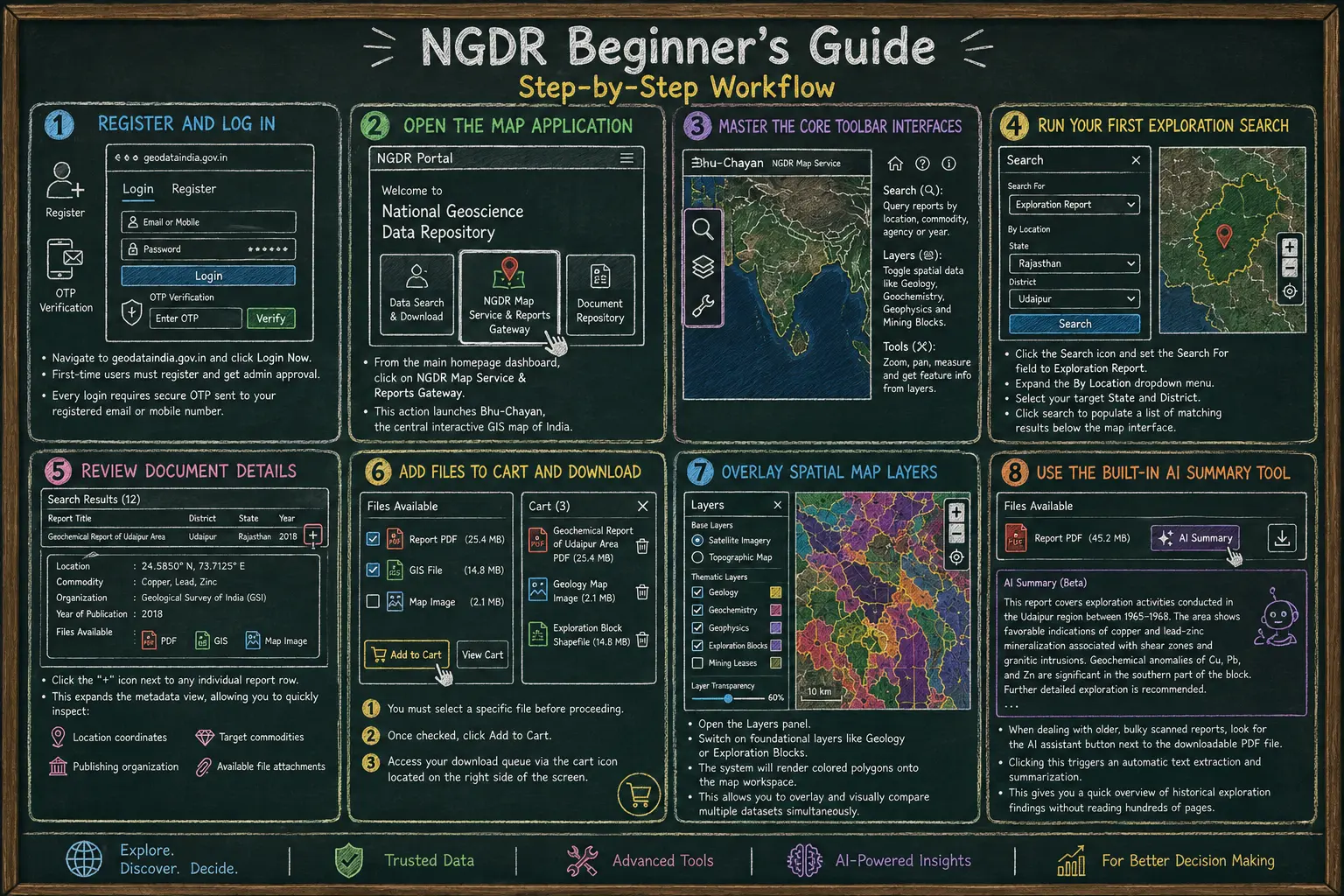
Step 4: Search for exploration reports
Select Exploration Report as the type of information you want to investigate.
The NGDR search interface allows exploration data to be filtered geographically and by commodity. Search results can include details such as:
- Report title
- Commodity
- Organisation
- Publication year
- Topographic sheet
- Spatial location
- NGDR identifier
The official NGDR guidance also allows users to investigate data through spatial selection tools and download resulting datasets.
This provides a quick way to establish what exploration history is available before opening individual reports.
Step 5: Review the available metadata
Before downloading a report, inspect the available record information.
Depending on the report, NGDR may provide information such as the exploration stage, project or block name, commodities, location and available associated files.
This is useful for reducing the number of irrelevant documents that need to be reviewed.
Step 6: Download the relevant source material
Reports may include different supporting files, including:
- Report documents
- Tabular data
- GIS files
- Georeferenced files
- Images or other supporting material
Select the information relevant to your investigation and download it for detailed interpretation.
Step 7: Explore the spatial layers
Reports are only one part of the NGDR dataset.
Use the map services to examine the spatial relationship between available geological, geochemical, geophysical and exploration information.
Instead of considering a historical report in isolation, you can begin asking questions such as:
- Where does the reported mineralisation sit within the regional geology?
- Is there supporting geochemical evidence nearby?
- Do geophysical anomalies coincide with prospective geological units?
- Has the surrounding ground received the same level of exploration?
- Are there project or exploration boundaries that affect how the area should be interpreted?
This is where NGDR becomes particularly useful as a regional exploration screening tool.
NGDR Has Changed the Data-Access Problem
The importance of NGDR should not be understated.
Mineral exploration depends heavily on understanding what has already been observed, tested and learned about an area. When that information is fragmented across agencies, reports and datasets, simply assembling the available evidence can consume a significant amount of exploration time.
NGDR provides the infrastructure to make much of that information discoverable through a common geospatial environment.
That is a major improvement.
But data access and geological understanding are not the same problem.
Once the relevant reports and datasets have been found, exploration teams still need to determine what the information collectively means.
The Next Bottleneck: From Geoscience Data to Geological Evidence
Imagine that an exploration team identifies 200 historical reports covering a prospective district.
Access to those 200 reports is valuable.
But the team's actual exploration questions are rarely:
Which PDFs exist in this district?
They are more likely to be:
- Where has mineralisation actually been reported?
- What alteration occurs around those occurrences?
- Which pathfinder elements were anomalous?
- Which targets were drilled?
- What were the drilling results?
- Which anomalies were recommended for follow-up but never tested?
- Why did previous explorers abandon certain targets?
- Did later explorers confirm or contradict earlier interpretations?
- Which areas appear underexplored rather than simply unsuccessful?
- Are observations made by separate explorers decades apart pointing to the same geological system?
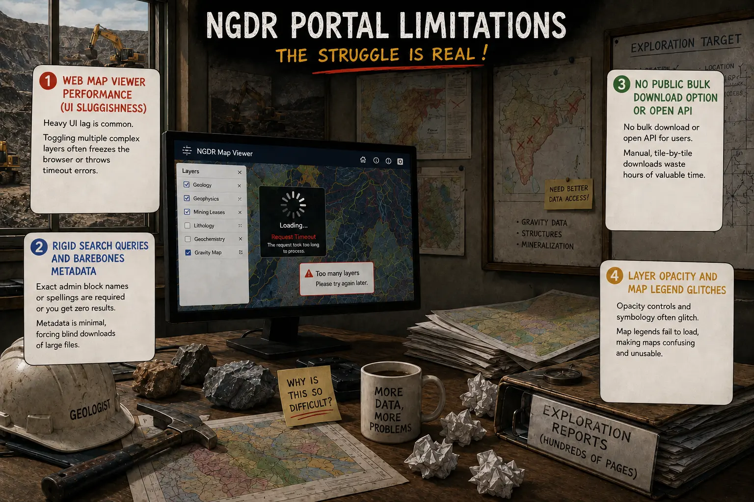
Answering those questions can require information to be recovered from narrative text, tables, figures, maps, drilling records and appendices across many different reports.
The challenge has therefore moved from:
"Can I access the data?"
to:
"What does all of this evidence collectively tell me about the ground?"
How RadiXplore Complements NGDR
NGDR and RadiXplore address different parts of the exploration information workflow.
NGDR helps make India's geoscience data accessible. RadiXplore helps exploration teams investigate and connect the evidence contained within that data.
RadiXplore is designed for the work that begins once an exploration team has access to large volumes of historical and modern information.
Instead of repeatedly opening individual reports and manually extracting relevant observations, users can investigate geological questions across multiple sources while retaining the connection to the underlying evidence.
A traditional historical-data workflow
Define an area → identify available reports and datasets → download relevant files → open reports individually → search for useful sections → extract geological observations → compare results between reports → map findings → determine what deserves further investigation
This works, but becomes increasingly difficult as the volume and variety of information grows.
An evidence-synthesis workflow with RadiXplore
Ask a geological question → recover relevant evidence across reports and datasets → connect related observations across sources and time → identify patterns, gaps and contradictions → understand where the evidence occurs spatially → inspect the supporting text, tables, figures and maps → trace findings back to the original source → decide what deserves investigation next
The distinction is important.
RadiXplore is not intended to replace the geologist's interpretation or predict where a deposit must occur.
It helps make the evidence required for geological reasoning easier to find, connect and investigate.
State-level example of how NGDR data can be explored and combined with interactive mapping and AI-assisted analysis, read our Maharashtra Mining Insights with NGDR & AI-Powered Tools case study
 Russell Menezes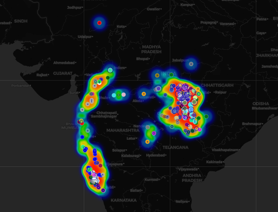
From Individual Observations to an Exploration Story
This becomes particularly useful when evidence is fragmented across many exploration campaigns.
One report may describe anomalous copper geochemistry.
Another, written 15 years later, may identify alteration nearby.
A third may contain drilling that tested one interpretation of the anomaly but not another.
A historical map may show a structural relationship that does not appear in the later report text.
Individually, each observation may appear unremarkable.
Together, they may tell a much more useful exploration story.
That is the difference between retrieving information and synthesising evidence.
RadiXplore helps exploration teams move beyond asking where is the information? toward asking what relationships become visible when the information is considered together?
For a practical example of this workflow, explore our Koratti Carbonatite REE Case Study, which shows how RadiXplore connected geological, geochemical, mineralogical and historical exploration evidence to reassess a rare-earth-element target in Tamil Nadu.
 faiz khan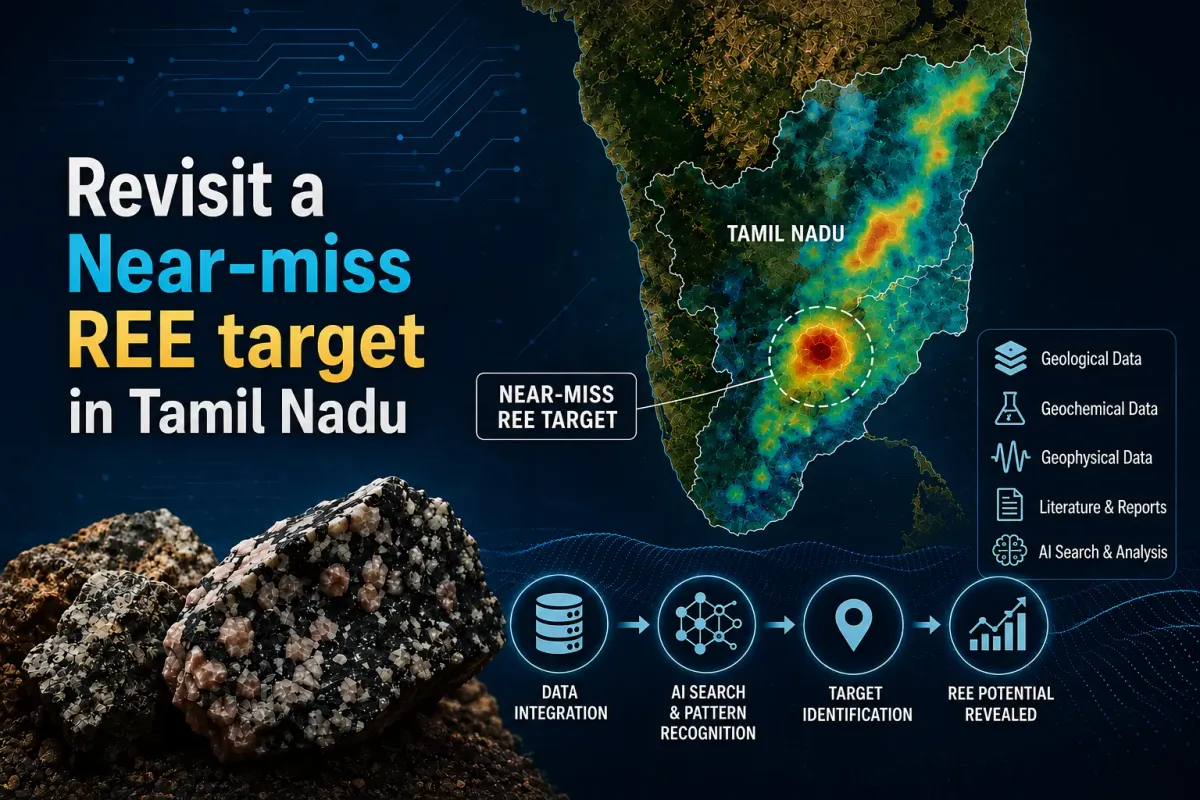
A Practical NGDR and RadiXplore Workflow
For teams evaluating mineral exploration opportunities in India, the two systems can form complementary parts of the same workflow.
1. Use NGDR to understand the available data
Start by identifying:
- Available exploration reports
- Geological coverage
- Geochemical datasets
- Geophysical datasets
- Historical project information
- Relevant spatial layers
This establishes the public evidence base available for the area.
2. Define the exploration questions that matter
Instead of beginning with every document, begin with the geological uncertainties you need to resolve.
For example:
- Has this structural corridor previously been tested?
- What evidence exists for hydrothermal alteration?
- Are reported copper occurrences part of the same mineralising system?
- Which historical targets remain unresolved?
- Where was exploration unsuccessful, and why?
- Which apparent gaps represent genuine exploration opportunities?
3. Investigate the evidence across sources
RadiXplore can then be used to surface relevant observations across the underlying exploration information and connect evidence that may otherwise remain separated between reports, maps, tables and exploration campaigns.
4. Validate against the original sources
Evidence should remain traceable.
Geologists can inspect the original supporting material, understand its context and determine how much confidence to place in each observation.
5. Decide where deeper geological work is justified
The result is not an automated exploration answer.
It is a stronger evidence base for deciding which areas, hypotheses and unanswered questions deserve the team's attention.
NGDR, Mineral Targeting and the Future of Exploration in India
India's mineral exploration data ecosystem is becoming increasingly digital.
NGDR has created an important national foundation by consolidating exploration-related geoscientific information and making it more accessible to explorers, mining companies, researchers and other stakeholders.
That foundation also creates a new opportunity.
As more historical reports, maps and structured geoscientific datasets become accessible, the competitive advantage increasingly shifts from who can obtain the information to who can understand and connect it most effectively.
For exploration teams, that means better use of historical evidence can become an important part of regional screening, opportunity assessment and target generation.
The goal is not simply to search more reports.
It is to understand what previous explorers observed, what they tested, what they missed and what remains unresolved.
Closing Thoughts
The National Geoscience Data Repository is an important starting point for mineral exploration in India.
It brings a growing body of geological, geochemical, geophysical and historical exploration information into a central environment and gives teams a far better way to understand what data exists across an area.
But access is only the beginning.
The next challenge is connecting observations across reports, datasets, maps and decades of exploration history to understand what the evidence collectively says about the ground.
NGDR helps you find what exists.
RadiXplore helps you investigate what the evidence means together.
For exploration teams evaluating opportunities in India, using both approaches can create a more efficient path from regional data access to evidence-backed geological investigation.